Luftronix Demos Software, Logic for Precision Indoor Drone Flights
Probably one of the most difficult problems faced by the drone industry is how to conduct indoor inspections, given the need for adaptability to variations in lighting and the capacity for precision flying in tight quarters.
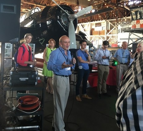
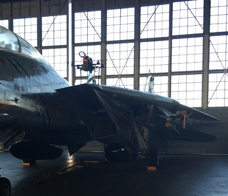
On June 22, Luftronix (Franklin Lakes) demonstrated an indoor navigation system, using a drone to inspect a vintage F-14 World War II fighter jet housed at the Aviation Museum at the Naval Air Station in Wildwood.
Despite a slight mishap, the drone’s flight was mostly a success, showing that this company is on the right track in terms of reaching its objective. An earlier practice flight revealed corrosion on the bottom of the F-14.
One of Luftronix’s founders is Denise Spell, who is also the CEO of Currant (Newark), a disaster relief management company. As CEO of Currant, Spell began investigating the incorporation of information gained by drones into her software to help emergency responders during crises. In the course of her investigation, she found the precision-navigation technology used by Luftronix.
NJTechWeekly spoke to Klaus Sonnenleiter, cofounder and CEO of Luftronix. Sonnenleiter noted that indoor inspections can shorten the time needed for passenger aircraft inspections. “With passenger aircraft, you have very long inspection times, and people need to do additional assessment as to whether planes can go back into service or need to be repaired.” That process is not easily automatable; and it isn’t easily repeated, in the sense that you will get the same results the next time.
“All of this can be fixed with the use of drones,” he said. “It’s a light-weight method, you can do it very quickly, and you get the same quality assessment. …The drone’s camera takes the footage you need, and then you can do a very quick check to see if there is anything you need to be worried about. In most cases the answer is no, and you want to get the aircraft back in service.”
The company makes precision navigation systems that can maintain indoor flight paths with centimeter accuracy in environments where there is no GPS. In most cases, the company uses drones that are off-the-shelf and then adds its hardware and software system, said Sonnenleiter. “With all of the different sensors we are using — distance sensors, altitude sensors, gyroscopes, cameras — we need to make sure that there is as little as possible latency between the readings from the different sensors.”
Latency is bad for navigation, he noted. “You think you’re here, but another sensor tells you you’re there. With the logic we’ve implemented in hardware, we get lower latency, so better readings and more reliable readings.”
Sonnenleiter said that most of the engineering for Luftronix’s precision navigation system — based on the Fused Flow algorithm in the system — comes from engineers in western Ukraine. “We’ve taken a technology that our parent company, ELEKS, in Ukraine, has invented, and we modified it, making it usable for drones. They are a software development company” that wanted a company to productize the software. Luftronix is a joint venture founded in 2015 by Roman Pavlyuk (CTO), Klaus Sonnenleiter, Denise Spell and ELEKS.
Besides aircraft inspections, Sonnenleiter and Spell see a wider use in humanitarian missions, where drones may be needed to clear the way for human intervention. Drones can make a quick assessment of what is going on, verifying if a place is too dangerous for humans to enter.
“Luftronix technology allows drones to fly through tunnels, over areas of collapse, through GPS-denied environments, and still be able to find those in need of rescue, and drop critical supplies until help can arrive,” Spell said.